
Planning software for battery storage and solar
From open field to site plan before the first landowner meeting.
Hectoplot screens land, lays out the project and produces the drawings for interconnection and permitting – in minutes, not weeks.
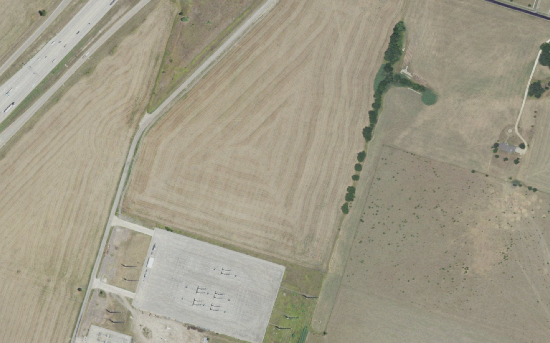
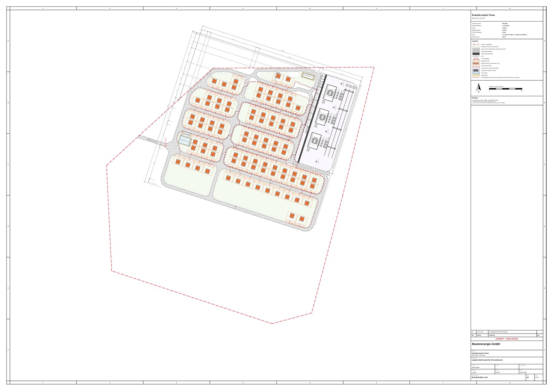
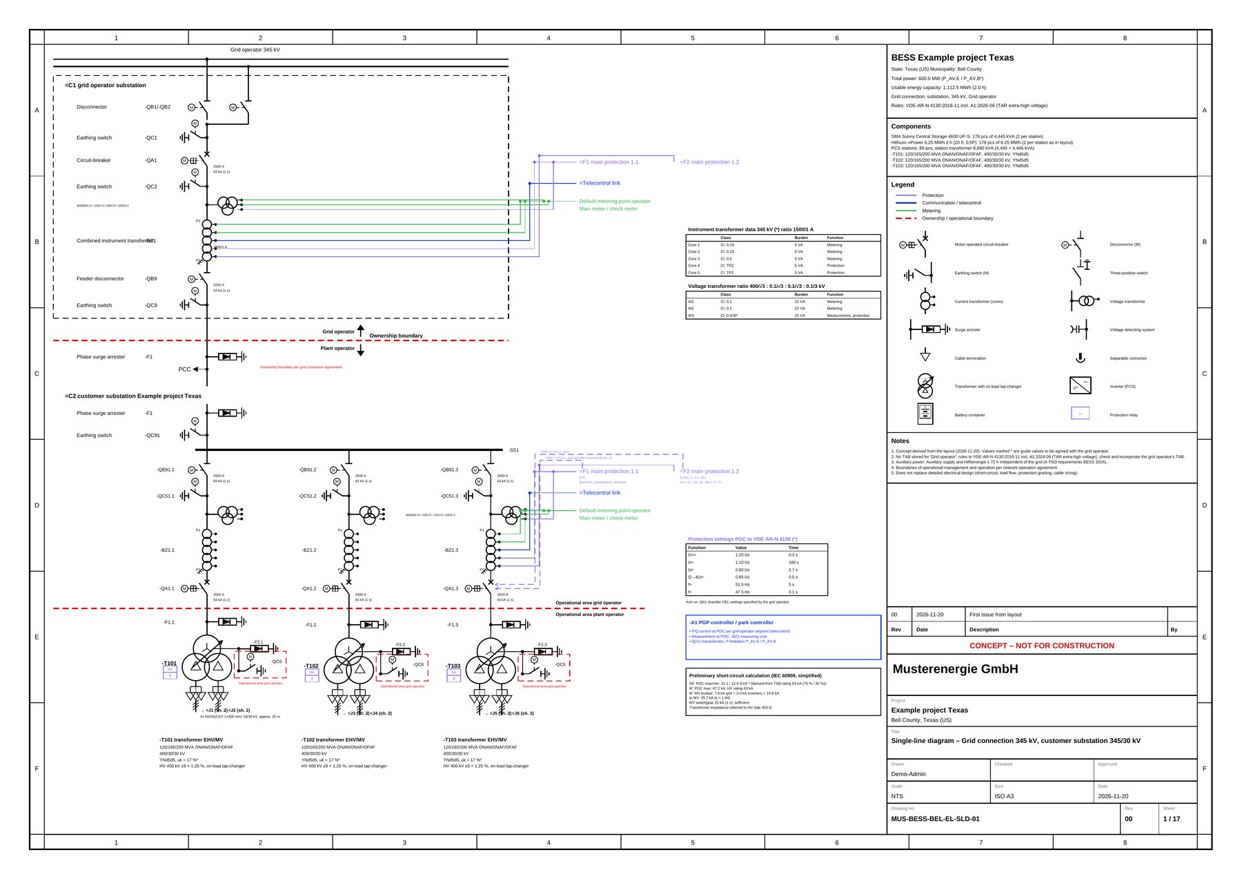
Aerial imagery: USDA NAIP via USGS The National Map, public domain. Grid: © OpenStreetMap contributors (ODbL). Wetlands: USFWS NWI. Protected areas: USGS PAD-US. Site plan and single-line diagram: unedited Hectoplot output, reduced.
28.6acres
Project area (11.6 ha)
539.6MW
Power at point of interconnection
1,112.5MWh
Energy capacity
178
Battery containers, 89 inverter stations
10:09min
Computation time, “thorough” search
Product
One tool instead of ten portals
Built from day-to-day work in battery storage development. Every feature replaces a step that would otherwise sit in another portal, a spreadsheet or with a consultant.
- 01Screening large areas
- Exclusion and setback rules as profiles, restrictions as map layers, a fact sheet with a traffic light for every site.
- 02Grid nodes and competition
- Substations and lines up to extra-high voltage, the grid operator at each location, existing storage at the node and a data sheet for the interconnection request.
- 03Site control as a team
- Parcels from the map, status, tasks, notes and documents for every project.
- 04Layout generator
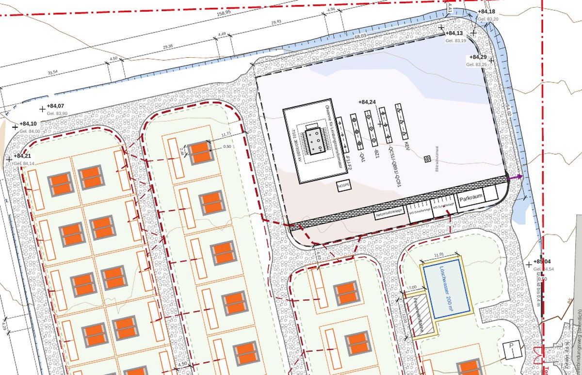
- Containers, inverters, roads, fence, substation and fire access from manufacturer profiles – as a quick draft in seconds or fully optimized.
- 05Terrain and noise
- Terrain model, pads and earthworks, noise prediction to ISO 9613-2.
- 06Electrical interconnection
- Single-line diagram and connection concept in English or German, with protection, metering and short-circuit data.
- 07Permitting and economics
- Site plan, elevations, project description, DXF export and a financial model with Excel export.
- 08Works with Claude
- Query projects, estimate layouts and create location maps – right in a chat with Claude.
Who it’s for
For everyone who develops, buys or engineers sites
01
Developers
Screen more sites and know sooner which ones work. Layout and capacity are on the table at the first landowner meeting.
02
Utilities and public power
Assess your own and municipal land in your service area without building a GIS team. Results that boards understand.
03
Investors and IPPs
Check offered projects quickly: does the site fit the capacity, how far is the point of interconnection, who else is planning there?
04
Engineering firms
Layout options, noise and single-line diagram as a starting point for detailed design, with export to DXF and Excel.
Hectoplot is a pre-screening tool based on open data. It does not replace review of original records, detailed engineering, utility interconnection studies or expert reports. The built-in open-data layers currently cover Germany; for sites elsewhere you provide the site boundary and the point of interconnection.
Request a demo
Your site, computed live
In an online session we work through a site or region you are interested in – from screening to layout.